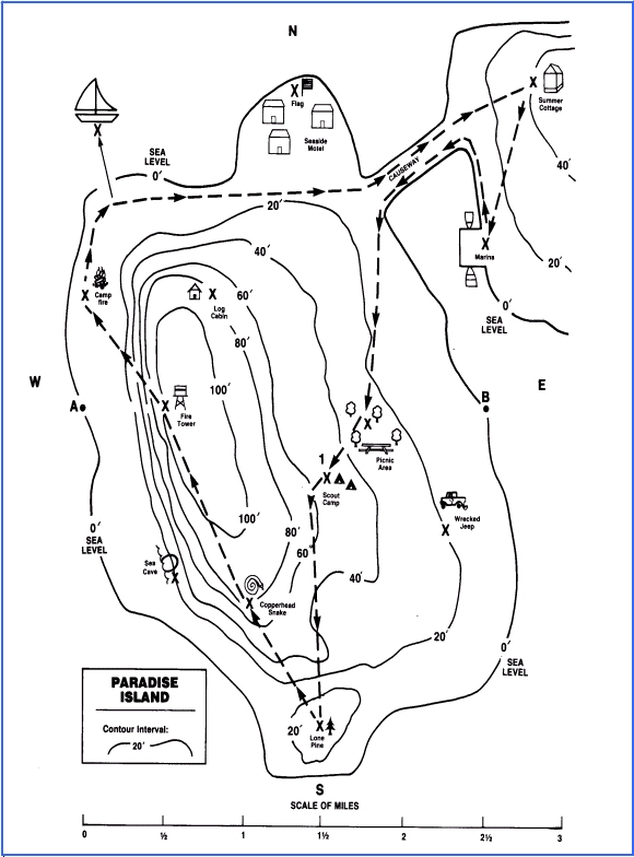
 The map shown below is a topographical-type map. Such maps show both natural (physical) and cultural (political) features.
Topographical maps tell elevation through the use of contour lines. Contour lines show how high a place is above the level of the sea. Every place on the line is the same distance above sea level.
Places in-between contour lines cannot be shown exactly. However, if a place is between the 20' contour line and the 40' contour line, for example, you know it is somewhere between 20' and 39' above sea level.
Practice reading elevations shown by contour lines by completing the activity below. In all of the questions, the X's show the location of the places.
- What is the elevation of:
- Fire Tower? ___________________'
- Scout Camp? Between ____________' and _____________'
- Wrecked Jeep? ________________'
- Log Cabin? ____________________'
- Sea Cave? ____________________'
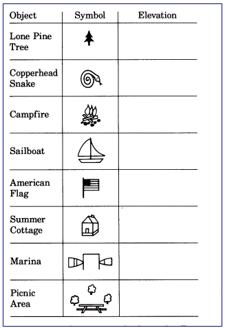
- Some of the scouts at the Scout Camp decide to hike the trail. They thought that it would take them about two days. They started at 1 on the map (next to their camp). On their way they saw or experienced a number of interesting things. At what elevation did they see the things listed in the table on the previous page?
- Contour lines tell the elevation of places. The space between the lines tells the distance between the lines. When the lines are close together it means that the slope is steep; if lines are far apart, it means that the slope is more gradual.
- Which is the steeper climb to the Fire Tower? ___A to the FT ___B to the FT?
- What is the distance from A to the Fire Tower? __________
- What is the distance from B to the Fire Tower? __________
- Which climb would you prefer? Why?
- What is the local distance on the trail from the Scout Camp to the first camp fire? About ___________________________miles